Our 79th Mystery Bridge takes us to Oklahoma; specifically to Whitesboro in LeFlore County and this bridge. Spanning the Kiamichi River at Township Rd. 4044C south of Whitesboro, this bridge is one of the most unusual through truss bridges a person will ever see in the United States. According to the data from Bridgehunter.com, the total length of the bridge was 270 feet with the largest span being 127 feet, the width of the bridge is around 13-14 feet and the vertical clearance is 13.3 feet. Yet despite the date of construction being ca. 1940, this bridge is unusual as it is a pinned connected through truss, thus bucking the standards of truss bridge construction. As many resources have indicated, most truss bridges built at this time had riveted or welded connections, making the structure sturdier and able to carry heavier loads. Pinned connections had a tendency of dislocating or even having the bolts connecting the beams to break off, causing bridge failure. This resulted in many of the structures being taken off the state highway system and relocated onto less-used township roads beginning in the 1920s and extending well into the 1950s, especially as the US was lacking materials and engineers as a result of World War II. Judging by the appearance of the bridge, it appears to have been built between 1910 and 1915 as this was the cut-off period for constructing truss bridges with pinned connections. It was congruent to the time standardized bridges were approved by the state governments, which included not just focusing on truss bridges with riveted connections and either Howe lattice or lettered portal bracings (namely, A, X, M and West Virginia framed), but also the key truss designs, which were the Pratt, Parker, K-truss, Warren, Polygonal Warren and in some cases, Pennsylvania petit.
The Whitesboro Bridge features a Warren through truss, but looking at the structure further, it appeared that in its former life, it was a deck truss bridge that had many spans, totaling at least 500-600 feet. One can see how the overhead bracings were added, which consisted of thin cylindrical steel beams. Furthermore, there is no portal bracing, like other truss bridges, and lastly, when looking at the joint where the upper beam and the diagonal end posts meet, the upper beam appears to have been sawed off. According to observation by fellow pontist, Mark W. Brown, the piers are 2-3 feet wider on each side and 1-2 feet higher, thus creating a slight slope when entering and crossing the structure. Two theories go along with the piers: either they were installed when the bridge was built or they were reinforced after the bridge sustained structural damage because of flooding.
It is possible that this crossing was the first to have been built as the town expanded because of the baby boomer population. But the expansion did not last as many people moved to bigger cities for job opportunities. As of the 2008 Census, the population of the town incorporated in 1908 and named after one of the founders is only 1298. The hunch is that the highest population of Whitesboro was about 3,400 by 1960.
The Whitesboro Bridge has a design that is not like any unusual designs developed by the engineers at all. It is neither a Pegram nor a Kellogg, now is it a Schaper truss, which you can see in many truss bridges built in Germany and other parts of Europe. This bridge is definitely a repurposed truss bridge, having gone from its previous life as a deck truss spanning one of the state’s greatest rivers, like the Red and the Canadian, to one spanning a smaller river but on whose width justified a through truss span.
This leads us to the following questions:
When exactly was this bridge built and was there a previous structure?
Who was the mastermind behind this repurposing project and why did the engineer choose this?
Where did the bridge originate from?
When was this built and who was the bridge builder?
Are there other remnants of that bridge left besides the one at Whitesboro?
What do we know about Whitesboro aside the facts and figures presented in wikipedia?
Got any leads, please share in the comment sections here as well as in the Chronicles’ facebook pages. You can also contact Jason Smith at the Chronicles, using the link here. As this bridge is eligible for the National Register of Historic Places, any information you have or can find will help build a solid case for its nomination, let alone preserving it for future generations. As Oklahoma is losing historic bridges in large quantities in the past 8 years, the time is ripe to preserve what’s left of its culture, especially when it comes to unusual designs like this bridge in Whitesboro.
Special thanks to Mark W. Brown for bringing this to the author’s attention and for providing some interesting pics of this bridge.
Back in October, I had a chance to interview Paul Loether of the National Register of Historic Places and Christopher Marston of HABS/HAER/HALS about the policies of designating and preserving places of historic places. The NRHP has a large database of historic places, categorized based on four criteria (see the interview here), whereas HABS/HAER/HALS deals with the documentation of places of interest, which includes historical and technical aspects (see that interview here). Some exemptions apply but based on special circumstances.
But what about freeways? How historic are they and which parts should be designated historic places? As Kaitlin O’shea documents in this column, freeways are much more difficult to document as much of them are modern. The Interstate Highway System was introduced in 1956, ushering in the use of freeways, using the system that existed in Europe before World War II, in particular, Germany and Poland. While historic highways, such as Route 66, Lincoln Highway, Jefferson Highway and parts of the Pennsylvania Turnpike have received some historic designation in one way or another, the Interstate highway is much more difficult to document and designate because the model used in the 1950s is still being used today, including ramps, bridges, rest areas and the roadway itself. Furthermore, the majority of the Interstate highways have been built from the 1980s onwards.
This leads to the question of whether certain exemptions can and should apply. This is where her column comes in. Have a look at it and ask yourself how an agency can and should approach this carefully.
Exemption from the exemption? If you’re in the regulatory + infrastructure world, you’ve likely come across this. If you are not, step into our world for a few minutes. By law (the National Historic Preservation Act of 1966), all projects that receive federal funding are subject to review under Section 106. Review includes identifying historic […]
This is a throwback article dating back to April 2011, when the author toured the bridges along the Grand Canal. Going in the opposite direction enroute to Kiel, this part focuses on the remnants of the Alt Eider Canal, which originally snaked its way across Schleswig-Holstein from Kiel to Tönning via Rendsburg and Friedrichstadt. While the western segment was converted into a river when the Baltic-North Sea Canal was built between 1890 and 1895, the eastern segment, running from Rendsburg to Kiel, was abandoned and as a consequence, many areas have become nothing more but ponds and small creeks with locks that no longer are in use. Using a map for this tour guide, here are some of the relicts worth visiting while on tour. 🙂
Lock at Rathmannsdorf minus the bridge removed. Photo taken in April 2011
After an hour of lunch, combined with a trek combing up along the west end of the Kieler Fjorde, passing the university and the state parliamentary building along the way, I ended up in the northernmost suburb of Holtenau, the starting point of the Grand Canal. Measuring about 95 km long and approximately 60 meters wide in many areas, it resembled the Panama Canal, which slices through the isthmus connecting North and South America. The only difference between the two is the landscape, which the Grand Canal goes through mostly flat land. Before the trip to Kiel to start on the journey, I bought a magazine bearing the name “Nord-Ostsee-Kanal” 2011 version from a book store in Flensburg and while staying at the hotel on the city’s east end of Mürwik, I learned about the canal’s history, let alone the origins, and decided to make a parallel bike tour where I could find and photograph the bridges along both canals, although I would risk not getting from Kiel to Heide before sundown. While my prediction did come true, there was no regret doing what I did, for I would not have had the chance to share my experiences travelling along the Alte Eider and the Grand Canals at the same time.
The Alte Eider Canal had a width of about 30 meters and was 4 meters deep in many areas. While its starting point was in Kiel Holtenau, its path represented a long snake slithering quietly through the flat lands, as the canal made a lot of really sharp turns. Since many ships passing through the canal at the time of its completion had no engines (they would come in 1830s), most of them were pulled by horse and manpower to avoid any collisions with the banks. The canal swerved through many small present-day villages with many locks along the way. They include the villages of Knoop, Pojensdorf, Rathmannsdorf and Schinkel northeast of the present-day canal and Kluvensiek, Bovenau, and Klein Königsförde located to the south and west of the Grand Canal close to Rendsburg. And with each village, there were series of locks- more than that of the canal today in its entire length- many of whom are all but relicts today, where people can come and see what they looked like when the Alte Eider had its heyday.
Each canal lock consisted of a bridge, built using a bascule design which permitted traffic to horse and buggy and ships when necessary. There are many different types of bascule (or draw) bridges that were created and developed. The Scherzer rolling lift style was used on the Lindaunis Bridge over the Schlei. In Schleswig-Holstein, double leaf bascules were used most often to span narrow canals like the ones that existed along the Alte Eider. Originating from neighboring Holland (today known as The Netherlands), double leaf bascules consist of two half-bridge spans, each of them supported by cables or chains that are anchored by towers located on each end of the canal. For a textbook style, the cables or chains are connected to counterweight, located above each tower, which if lowered by manpower (or in today’s case machine), lifts the half-span to its vertical position to allow the ships to pass through. To lower the half-span, the weight is lifted up and back to its position above the tower, and the roadway is anchored down in a horizontal position, allowing horse and buggy to pass. An example of this bridge can be found in one of the pictures below. These types are still being used today in Schleswig-Holstein for small crossings including those along the Eider River in the western part of the state. More on that in the second segment. At least eight different locks had bridges of this type in service before the Alte Eider was made obsolete by the Grand Canal, one located in each village. This included the ones in Rendsburg, Kluvensiek and Klein Königsförde, which is profiled at the end of the column.
Example of the double leaf bascule bridge at Klein Königsförde Photo taken in April 2011
When the Grand Canal opened to traffic in 1895, the Alte Eider Canal lost its significance and was subsequentially put out of service. Much of the canal was filled up with silt, while other sections were dismantled and buried with dirt by farmers in an attempt to convert it into farmland. Some of the locks were dismantled with the bridges removed, while others were left as a landmark signaling the canal’s heyday. One can see some of these landmarks today when trekking along the remains of the Alte Eider Canal. This includes a Toll house in Pojensdorf, which has since been converted to a museum dedicated to the history of this architectural landmark. There is a restaurant in Rathmannsdorf, located in front of the lock, which serves local delicacies. In Schinkel, a mansion-style hotel built in the early 1800s still exists today, despite being privately owned. Mills can be found in places like Kluvensiek and Bovenau. Parts of the Alte Eider were converted to harbor for yachts in Rendsburg. And one can find bridge relicts in Klein Königsförde and Kluvensiek, the former being a replica of the one that existed before the Grand Canal opened, the other partially filled in but has a history of its own, when looking at the tower’s portal bracings.
Of the eight bridges that existed, four have been profiled here, although one of them no longer exists. They are arranged in the order of direction of the canal, from Kiel to Rendsburg, starting with the first bridge at Pojensdorf.
Pojensdorf Bridge Built in ca. 1900 Photo taken in April 2011
Pojensdorf Bridge: Spanning the Alte Eider Canal
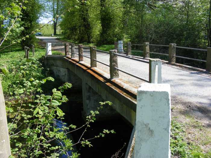
Spanning the Alte Eider between Knoop and Pojensdorf, this steel stringer bridge may have replaced a lock and bridge that existed when the canal was in service. The bridge serves as the entrance to the village of Pojensdorf. While the bridge represents a typical short-span stringer bridge used on many roads in Germany, if one goes beyond the bridge and enters Pojensdorf, one will appreciate the landscape that was created by the old canal, let alone the Packhaus in Pojensdorf which was converted into a museum devoted explicitely to the history of this unique canal.
Towers of the Kluvensiek Bridge Photo taken in April 2011
Kluvensiek Drawbridge:
This (now former) drawbridge is probably the most ornamental of the bridges that spanned the Alte Eider Canal. The bridge was built in 1849/50 with the portal towers being designed by Carlshütte Iron Works in Rendsburg. Founded by Markus Hartwig Holler in 1827, the iron works company contributed a great deal with the construction of bridges and other forms of infrastructure along both the Alte Eider and the present Baltic-North Sea Canals up until the Grand Canal’s completion in 1895. However, the company’s heyday did not come until the Ahlmann family took over the business in 1909 and Kate Ahlmann took over the business when her husband Julius died in 1931. She had as many as 3000 workers at the iron works company by the 1950s and contributed a great deal to the economic growth in Rendsburg. Shortly before her death in 1963, a museum dedicated to the history of Carlshütte opened with numerous displays of artwork made of iron, which can be seen today. Sadly though, Carlshütte went into decline after her death and despite surviving one bankruptcy in 1974, the second one in 1997 led to the company’s liquidation. Carlshütte was named after Carl von Hessen, who governed Schleswig-Holstein at the time of the company’s founding.
When the canal was made obsolete by the Grand Canal, the lock was filled in with the exception of a small culvert to allow water to pass underneath. This included the bridge itself even though the two towers still remain standing and can be seen from the road heading to Kluvensiek from Bovenau and the Alte Eider bike trail.
Foundation with Carlshütte engraving. Photo taken in April 2011Roadway fill over the lock remains Photo taken in April 2011Portal view of the bridge at Klein Königsförde Photo taken in April 2011
Drawbridge at Klein Königsförde:
Coming up on Klein Königsförde, one will see a replica of a piece of history spanning the Alte Eider Canal on the old locks. Originally there was a bridge that was constructed in the mid-1800s using the double-leaf bascule design, and consisting of towers with an arch design. Yet before the Grand Canal was completed in 1895, the bridge was taken down and not replaced for over 100 years. In the early 1980s a replica of this bridge was constructed using mostly wood for the structure and steel chains for tower support as well as lifting the roadway, even though the crossing is in a fixed position. The purpose is to show the tourist what the bridge looked like during the days of the Alte Eider Canal. The bridge received the Europa Nostra award for its artwork in 1989 and is still in use for pedestrians and cyclists only. A park is located next to the structure on the west end to provide an opportunity to rest and view the village, located on the eastern side of the canal.
Photo taken in April 2011
Rendsburg Drawbridge:
Subtracting the city of Lübeck, located on the border to Schleswig-Holstein and Mecklenburg-Pommerania, if there is a city that can be considered the one with the most number of bridges worth seeing and learning about in Schleswig-Holstein, Rendsburg would be the place to look at. The city can pride itself for its High Bridge (which will be mentioned in the later columns), but it can also pride itself on the history of bridges that spanned both the Alte Eider and Grand Canals. The Rendsburg Drawbridge is one of the bridges that made the city popular. While there were numerous bridges of this type that were built in and around Rendsburg, this one stands out as it served a main road connecting Hamburg and Flensburg. Furthermore it was one of a few built using iron and may be one of the structures built using the iron from its production facility Carlshütte. Sadly, when the new canal was completed in 1895, the bridge lost its importance and was subsequentially removed. The canal eventually was converted into a harbor, which is still in use today for smaller boats entering and exiting the Grand Canal. Interesting enough was the fact that before the canal was made obsolete, an arch bridge took its place for a while but it is unknown when it was built and when it was removed. Also worth noting is the fact that the drawbridge was overshadowed by bigger and longer bridges spanning the longer canal- one for the trains (High Bridge) and one for the road.
After a tour of the bridges along the Alte Eider Canal, the last segment of the revised tour guide series along the Grand Canal will focus on Kiel, its easternmost terminus. Apart from some neat bridges in the city center, there are some to the east of the city along the Schwentine that are worth noting and visiting. The Schwentine also empties into the Baltic Sea through the Kiel Fjorde but opposite the terminus of the Canal.
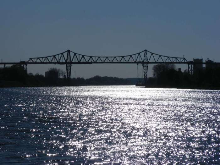
Rendsburg High Bridge in Rendsburg, Germany Photo taken by the author in April 2011
Information:
Location: Baltic-North Sea Canal at Rendsburg, Schleswig-Holstein, Germany
Description: Main span: Cantilever Warren through truss with transporter (main span), steel trestle approach span (south) and loop approach (north)
Length: 7 km (total) Of which: 2468 main span; loop approach 4.5 km
Built: 1913 by Friedrich Voss and C.H. Jocho of Dortmund
Travelling north to Flensburg on the Schleswig-Holstein-Express (the SHE) one evening in May 2010, I was chatting with four passengers heading home to the Rum capital of the world, talking about break-ups, broken marriages and partners cheating on them, when we suddenly found ourselves taking off from the ground. To think that most of the German state is flat consists of mainly farmland and coastal areas, to go from travelling on the ground to travelling in the air in a matter of seconds is like Eliott and E.T. flying in the air by bike. Yet the sound of metal to metal contact, especially when going over the steel towers revealed that whatever we were crossing was huge, the spectacular view of the lights of the town below and the body of water covered in emerald green lights was gorgeous. After going through the steel truss mechanism, we made our descent in a curly-Q fashion before touching the ground and stopping at our next station. Our conversation had stopped in favor of the structure’s admiration, a sign that homage needed to be paid to a gigantic symbol that bridges the past with the present, the lover on one place with one in the other, and the impossible with the reality.
Especially the last one is what describes the Rendsburg High Bridge, spanning the Baltic-North Sea Canal in Rendsburg, located between Hamburg and Flensburg. The bridge was the masterpiece of Friedrich Voss, who had built two other structures along the Grand Canal at Hochdonn and Kiel as well as numerous others in the northern half of the country, concluding the two-span arch bridge at Friedrichstadt. It took 1.5 years to build the main attraction along the canal, which after 104 years, it still serves as the anchor that makes the Grand Canal and Rendsburg the place to visit. What Voss did with the bridge was unthinkable, impossible and even insane in the eyes of many locals during that time. While steel trestles and a through truss design were his signatures for long-span structures like the aforementioned bridges, Voss needed a main span that would carry both horse and buggy (and later cars) as well as rail traffic. Henceforth as one of the feats, Voss chose the cantilever Warren span, whose roadway would serve rail traffic connecting Hamburg and Neumünster to the south and Flensburg and Scandanavia to the north. Hanging from the main span is the transporter span, which even today carries cars, bikes and pedestrians across the canal between Rendsburg and Aldorf. The transporter operates four times an hour in both directions during the day and takes 4-5 minutes to cross, half as long as when crossing the entire bridge via SHE.
Even more unique is the north approach. Already in existence was the train station for it served rail traffic between Kiel and Husum, the problem came with how the approach span should descend from 50 meters above water to just over zero. This was where Voss referred to the history books and chose the loop approach. Using the Hastings Spiral Bridge as reference, the loop approach provides travelers with an opportunity to gradually glide down from the bridge, making a circle of 360°. The 1895 bridge over the Mississippi River was the first bridge to feature this loop approach for engineers and bridge builders at Wisconsin Bridge and Iron Works had the problem of the bridge extending into Hasting’s business district, which already had numerous buildings and traffic at that time. Therefore, the south approach consisted of the loop approach, thus encouraging cars to glide down into the city center like a marble.
The problem was similar with the north approach, as it consisted of much of Rendsburg’s city center and housing area, combined with remnants of the old canal and the harbor area connected with the new canal. Therefore, Voss and his men devised a plan where a loop approach would feature first a series of steel trestles at the height of between 40 and 50 meters above water level, followed by earthen berms with concrete arch spans crossing main streets, after the descent of 40 meters. A Warren deck truss span crosses the rail line as it approaches the end of the loop. The total length of this loop approach alone is 4.5 km. The area the loop encircles consists of housing and therefore was later named Schleife.
On 1 October, 1913, after 1.5 years of work, Voss and 350 of his men from the bridge-building firm C.H. Jucho of Dortmund completed the work, and the bridge was open to traffic. The bridge and transporter complex has operated almost unaltered ever since, sustaining minimal damage in World War II. The bridge was rehabilitated with rust protectant being added to the steel bridge between 1993 and 2012. The rail line was electrified in 1995, which resulted in the portal and strut bracings of the through truss span being lifted. Instead of the two-rhombus portal bracing, the main span now had A-frame portals, high enough for trains to pass through. Sadly though, the transporter portion of the bridge is being replaced even as this article is being reproduced for this page. On 8 January 2016, the transporter collided with a ship as it was passing underneath the bridge. The boat operator and another passenger were injured in the wreck. After thorough investigations by the local authorities and the Ministry of Transportation, it was concluded that the transporter could not be salvaged and was therefore removed from the bridge. A replacement replicating the original transporter is currently being constructed and should be installed by 2017/18.
I had a chance to visit the bridge again in 2011, this time filming the crossing of the bridge and its transporter, but also following the path of the bridge from the start of the loop approach on the ground to the main span. While I never got a chance to see the Spiral Bridge as it was torn down in 1951, the Rendsburg High Bridge is nothing anyone has ever seen before. It is amazing just to be in a small suburb that is encircled by the loop approach, listening to trains cross it on an hourly basis. Its tall and towering trestles cannot be missed when travelling through Rendsburg. But the main span is just as amazing, for it has a total height of 68 meters, visible from 20 kilometers, making it one of the tallest structures along the Grand Canal. But I also noticed that the bridge with its wonderful work of art has not yet been recognized on the national and international scale. With the Vizcaya Bridge being nominated as a UNESCO World Heritage Site in 2013, the Firth of Forth Bridge scheduled to be nominated in 2015, the Rendsburg High Bridge Complex should be considered another UNESCO site as well because of the engineering feats that Voss accomplished in building this superstructure but also because the bridge still functions as a normal crossing of its kind today, just like it did when it opened to traffic in 1913. This is something that has made Rendsburg famous and makes it one of the wonderful works of art in Schleswig-Holstein, Germany and central Europe. Already it was given the Historische Wahrzeichen der Ingenieurbaukunst in Deutschland Award (Historic Recognition of the Works of Engineering in Germany) in 2013, on its 100th birthday. Chances are, more accolades will follow for this iron lady, whose total length of 7 kilometers (2,400 m main span) still makes it the longest railway bridge in Germany.
To close this documentary about this bridge, the third and most important part of the Tour along the Grand Canal, there is a saying that applies to any bridge enthusiast. You are never a true pontist unless you visit at least a couple key engineering works. In my book, one should really pay homage to the Rendsburg High Bridge. It is an engineering work of achievement that is underrated and something that awes every engineer to this day. Every engineer has his creative talents, which Voss had when building this bridge. It has withstood the test of time and is still a work of art one should see, when visiting Germany. It is hoped that it will one day be a UNESCO site. It will eventually for it deserves this honor.
Author’s note:
You can view the photos of the Rendsburg High Bridge via facebook site. Click here to have a look at every aspect photographed during my visit in 2011.
Some videos of the bridge can be viewed below as well:
And some links to provide you with some more information on the Rendsburg High Bridge:
This bridge was used as a logo for the Bridgehunter’s Chronicles from 2011 until its retirement and replacement with the current logo in 2015 using another Schleswig-Holstein bridge in its place, the Fehmarn Bridge. This is what the Rendsburg variant looked like.
The location of the Rendsburg High Bridge and the train station can be found on the map here:
This is a blog about my project of visiting every bridge over the Genesee River and what I learned about the history, structure, and natural surroundings of each bridge.