Bridge Vibration: Can a bridge bounce?

Delaware River Bridge at Lackawaxen PA- one of the first suspension bridges built by John Roebling and Russell Lord. In use since 1849 and listed on the National Register of Historic Places. Photos courtesy of HABS HAER

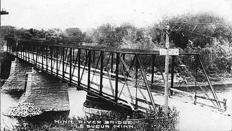
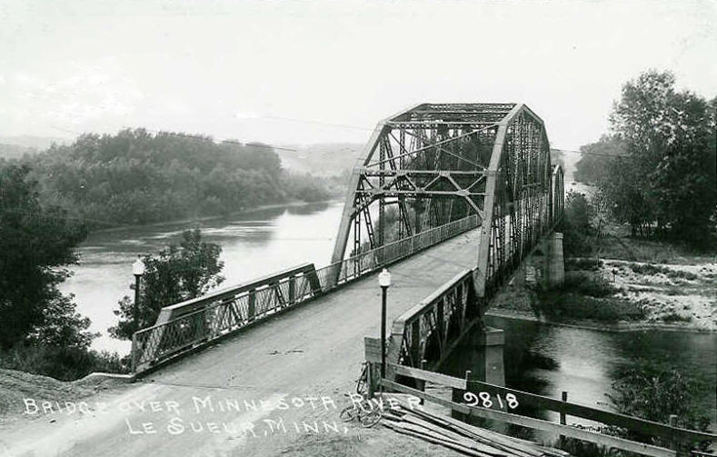
To start off this terminology page under the word Bridge Vibration, there is a story that is connected with this bridge. The Lackawaxen Suspension Bridge was built in 1849 by Russell Lord and John Roebling and spans the Delaware River bordering Pennsylvania and New Jersey. Together with the suspension bridge in Nuremberg (Germany), they are the only bridges of its kind in the world where the roadway is supported by odd-numbered towers. This in addition to the fact that they were both built before 1870. But the story goes where teenagers in the 1920s and 30s would try and race their cars across the bridge, then stop abruptly in the middle, creating a wave of vibration that would shake the wooden planking of the 300 foot structure! A dangerous stunt for it could lead to the bridge to collapse, but in those days, a carefree attitude towards bridges did not include liability issues like we have nowadays.

And this is where we look at the topic of Bridge Vibration. Can a bridge vibrate and if so, to what extent can it vibrate in order to make it safe?  This is in connection with some discussion about bridge vibration and how unsafe it is. Three bridges- two in Battleboro, New Hampshire and one bridge at Sylvan Island in the Quad Cities were the primary focus of this issue. City officials in the Moline (IL) portion of the Quad Cities feared that bridge vibration would mean that the potential for bridge collapse was there and subsequentially closed the bridge to all traffic this past May. The 1911 Pratt through truss structure, once serving as the lone key access to Sylvan Island, is now scheduled to be replaced this fall with a concrete structure that is not meant to bounce. The Charles Dana and Anna Hunt Marsh Bridges in Battleboro were on the hot seat lately due to suspected negligence on the part of the New Hampshire DOT and vandalism by someone who justified his actions on bridgehunter.com and claimed that a 250 foot bridge does not bounce. Both bridges are scheduled for replacement in 5-10 years time.  This leads to the question of whether a bridge can or has to bounce. After inquiring about this with some bridge engineers who have worked with this topic, the answer to that question is yes, but with certain restrictions. Says Todd Vierendeel, who works for an engineering firm in South Dakota:  “All bridges will experience some amount of deflection under load. The repeated loading and un-loading of spans due to transient loads (truck and pedestrian) can generate the sensation of vibration, or “bouncing” as has been described here. Excessive deflection and/or vibration can cause structural issues, but it’s actually not desirable primarily from a user comfort perspective.”  Billy Wulff, a bridge engineer from Quickborn, Germany, compares this sort of vibration to a plank sitting on top of a box whose expansion and contraction is restricted in contrast to the plank.  Therefore, “…engineers build in tolerances (which they calculate) of movement.” He also added that engineers have tried to construct lighter bridges, using the same materials for both the structure and the flooring, in order for it to not move.

The danger to such vibration is that too much of it, combined with the usage of light-weight materials for bridge construction will lead to structural failure. Many bridges have collapsed because of what Wulff calls misunderstanding of science combined with unsuitable materials. The most classical example was the collapse of the Tacoma Narrows Bridge in Washington in 1940. There, too much light materials for the bridge deck on “Galloping Gertie” resulted in excessive bouncing in 40 mph wind, resulting in the bridge’s collapse.  Video of the collapse can be found here.  To regulate the vibration on all bridges, transportation agencies have bridge design codes to ensure that there is a certain tolerance to the bridge vibration; this applies to agencies responsible for highways and railroads, but as Vierendeel states, the guidelines are more stringent for pedestrian bridges as they can notice the vibrations more than automobile drivers or train conductors.

But for older bridges, like the aforementioned bridges, he adds that more care is needed to ensure that the vibrations do not cause any discomfort among drivers and pedestrians, namely because of the increase in loads going across the bridge.  Therefore, some adjustments, like additional beams, weight restrictions, and extensive maintenance are needed to prolong the bridge’s life. As for bridges that are closed to vehicular traffic but open to pedestrians, such bouncing is considered normal for as they were used to vehicles crossing it, its tolerance may have increased over the years, making the bouncing sensation more pronounced. Yet, as many experts have mentioned, it does not mean that the bridge is unsafe and sometimes, additional support and retrofitting the bridge deck to reduce the vibrations is what is needed to prevent any discomfort of bridge users. This happened with the Millenium Bridge in London, where fluid and mass dampers were retrofitted to reduce the vibration frequency caused by many people crossing the bridge.

So to answer the questions, yes it is possible for bridges to vibrate when crossing, but only within tolerances that are imposed in bridge designs approved by transportation agencies. Should bridges witness any excessive vibrations, it is possible to fix the problem by adding support to the decking and retrofitting bridge parts to ensure that the vibrations are at a minimum. There is no such thing as a bridge not vibrating because of factors involving temperature differences combined with the volume of traffic crossing the bridge.  This leads to the question of the necessity to tear down bridges that vibrate when it is all part of the way the structure functions. Sometimes some minor repairs to bridges like the ones mentioned combined with continuous maintenance is all that is needed to ensure that the bridge lasts longer and the tax payers do not have to suffer as a result of tearing down a bridge for something whose quality cannot match that of the one that is destined for the scrap heap.  While it may be too late to save the Sylvan Island Bridge, it is something officials in New Hampshire and other states should consider before deciding on replacement over restoration.

The author would like to thank Billy Wulff and Todd Vierendeel (the names and occupation were changed to protect their identity) for their help in clarifying this topic.


ASCE Bridge Photo Viewers’ Choice Award 2013

Photographers on the Old US 66 Bridge over the Mississippi River East Chanel east of St. Louis. Photo taken by James Baughn in August 2011

With a number of bridge photographers increasing in vast numbers, surely there would be a bridge photo contest to encourage them to submit the best ones for a grand prize right?

In the eyes of the American Society of Civil Engineers, the answer is yes. For the first time ever, the ASCE opened the bridge photo contest in March of this year with 13 winners announced in July (see link here) and 20 finalists selected for the Viewer’s Choice Award, which is taking place between now and the end of this month.

If you are interested, you can click here, and view the photos for the Viewer’s Choice to determine who should win the award. Winners will be announced on 1 October, some of them will have their bridge photos featured on the 2014 ASCE Calendar. 12 of the bridges are located in the US and five are in Europe. Join in on the voting and the Chronicles will inform you of the winner via Newsflyer as soon as it is announced.

Note: If you missed out on the photo contest, not a problem. The Chronicles will soon open up the Ammann Awards for the third time this year. More information to come in October, as the Awards nomination will start a bit earlier this year.

The Bridges of Des Moines, Iowa Part I: Night bridge photo tour

35633993_10214201151177006_3677238874418970624_n
Green Bridge at 5th Avenue Photo taken by Chris CJ Johnson

This bridge tour is the first of a three-part series that will focus on the bridges of Des Moines, Iowa, one of the main stops for this year’s Historic Bridge Weekend.

How many of you have a digital camera and enjoy taking photographs of places of interest at night? If you enjoy taking night photography as much as I do, what places have you gone to and spent extensive time taking some pics at night? And which objects are your favorite to photograph at night?

With the development of digital cameras and the invention of different ways to photograph places, the interest in taking night photographs has increased exponentially in the last decade for reasons that you can take as many pictures of places of interests from different angles, sort the pics out and take the best ones that you can take pride in. With the increase in interest in places of interests, many city designers have gone out of their way to light up the places of interest at night to encourage photographers to walk the streets at night and take some snaps digitally, as can be seen in a classic example with the city of Flensburg, Germany, where yours truly went wild over night photography in 2010 and 2011 and has an article with some samples to prove it. (click here to view the photos.)

The same applies to historic bridges as well, as many cities have accomodated pedestrians and cyclists with a set of lighting on the bridges not just for the purpose of safety but for the purpose of making them more attractive. This takes us to the city of Des Moines, Iowa’s state capital and one of our major stops during our historic bridge tour in August 2013. With a population of over 250,000 inhabitants (700,000 counting the metropolitan area, Saylorville region and Ankeny), the city has one of the highest densities of bridges in the Midwest, competing with Minneapolis-St. Paul, Sioux Falls, Quad Cities and even Chicago, just to name a few. A third of the bridges consists of those built in 1945 and earlier, but there are some substantial bridges that have been built with aesthetic appeal since 1990. And there are quite a few that are decorated with lighting, creating an “Aha-Effect” for people walking along the Des Moines or Raccoon Rivers, the two primary waterways serving the city.

Despite construction of a new floodwall along the river to prevent future flooding (the last ones occurring in 2010 and 2011) and one bridge closing due to structural concerns, we had an opportunity to tour some of the bridges in Des Moines and are providing you with a sneak peak of some of the bridges you can see while touring Des Moines, so that you can plan a future trip there and even take some pictures for yourself.

Jackson Street Bridge BH1
Fifth Avenue/ Jackson Street Pedestrian Bridge in Des Moines. Photo taken in August 2013
Jackson St. Bridge BH2
Side view of the Jackson Street Bridge.

Fifth Avenue Bridge over the Raccoon River: This 400-foot bridge can be seen easily from the 2nd Street Bridge, its replacement, with its white light illuminating on the color of lime green that covers the three-span Pratt through truss bridge. This bridge was built in 1898 by the King Bridge Company at the time the bridge building company was at its peak in its history. The portal bracing was later adopted by George E. King when he started his own business at the turn of the century. The bridge was converted to a bike trail crossing with a few benches for people to sit down. Yet sadly, the bridge has been closed to traffic since March of this year due to structural concerns. Still, one can  see the bridge lit up, providing an opportunity for many to pay homage to a piece of history. Hopefully the structural issues will be resolved so that it can be reopened again.

Meredith Bridge
Meredith Bike Trail Bridge


Meredith Bike Trail Bridge: Also known as the Water Street Bridge, this bridge represents a classic example of one of many deck arch bridges built in the 1930s (this one was built in 1937) that will be mentioned in Part II of the tour. Located over the Raccoon River at the confluence of the Des Moines River, the bridge serves the bike trail combs the west bank of the Des Moines River. City officials in 2006 allowed planners to convert a vehicular crossing into a park filled with vegetation and benches, allowing people to enjoy the view of Des Moines’ skyline, and pontists to spend time at that bridge as well as its adjacent Scott Avenue Bridge.  The bridge and its skyline can also be seen from Mullet’s restaurant, which is also located at the confluence and serves local specialties and fish entrées typical for the region.

Des Moines skyline
Des Moines skyline and Iowa Cubs baseball stadium. Taken from the Meredith Trail Bridge
Scott Avenue Bridge
Scott Avenue Bridge at sundown. Located adjacent to the Meredith Trail Bridge
MLK Bridge 4
Martin Luther King Bridge

Martin Luther King Bridge: Built in 2005 as part of the Parkway project honoring the civil rights activist, this crossing features two bridges, one for each direction of traffic, and blue lighting on the outer piers illuminating the Des Moines River. That combined with a row of white LED lighting gives the bridge a blue appearance. Though while work was going on at the bridge to raise the east bank, we were given a treat with this view of the arched piers reflecting off the bridge, reminding the author of the I-35W Bridge in Minneapolis.

red bridge
Red Bridge spanning the Des Moines River in Des Moines. Photo taken in August 2011
Red Bridge
Red Bridge


Red Bridge: Also known as the Norfolk and Western Bridge, this 500 foot long two span Pratt through truss bridge was built in 1891 and spans the Des Moines River. After the railroad abandoned its line and bridge in 1995, the city bought the bridge and integrated it into the Principal Walkway system in 2006, while giving the bridge a new deck, cherry red paint and mirror reflecting lights, giving the bridge a unique light red color that is appealing both day and night. Yet the bridge was not lit up during the visit in August and for a good reason: As part of the plan to raise the flood wall, the bridge will be raised by four feet to ensure that floodwaters pass through the city without incident. Already the decking was raised and it is expected that the truss spans will be raised by the middle of next year. Only afterwards will the bridge return to its original form, lit up for people to see again.

red bridge dm 2
Close-up of the Red Bridge and the decking already raised by four feet as part of the flood-prevention project.


Center Street Bridge 1
Center Street Bridge in Des Moines, Iowa (USA)

Center Street Pedestrian Bridge: This is the youngest and one of the fanciest of modern bridges in Des Moines. Built in 2010 as part of the 125th anniversary of the Principal Financial Group and the project to develop the bike trail, this steel through arch bridge features an arch suspended by still vertical cables, that serves as a divider for the decking designated for bike trail and pedestrian trail. From the air, the decking resembles a football. The bridge was shortlisted for the Bridge Engineering and Design 2011 Footbridge Awards. But it may be one of the bridges listed for this year’s Ammann Awards, not only because of its design but also because of its appearance at night. With the lighting illuminating the arch, which can be seen from I-235 and from the Red Bridge, it makes a perfect picture if taken with the skyline in the background, as shown above. Yet the dark side is the fact that the bridge may be the least safe of the bridges for it is a meeting place for gangs and violence. So when at the bridge at night, please take extra precaution to ensure your’re safe.

bot garden bridge
Botanical Garden Tied Arch Bridge

I-235 Tied Basket Handle Arch Bridges: The last stop on the night tour are the I-235 Tied Arch Bridges. Built in 2005 as part of the project to widen and improve the interstate through the city center, one will not miss the three blue and white-colored tied arch bridges located within a distance of three miles of each other. This is especially the case at nightfall when they are lit, providing a stark contrast to the yellow sodium street lamps that line up along the interestate.  The arch bridges are located as follows, driving westward:

Edna Griffin Memorial: between 6th Street exit (access avaiable there only) and the Des Moines River. Perfect site for a photo with the skyline in the background.

Center Street: east of 42nd Street exit. Access either at Center Street (south of I-235) or Rollins Avenue/ 40th Place (north of I-235)

Rider Way: West of 42nd Street exit. Access through Center Street at Roosevelt High School.

Rider Park B
Rider Park Bridge


If one has to sum up the night tour of the bridges in Des Moines in one word, it would be awesome. Each bridge has its own character which is illuminated quite clearly at night when driving past, making the driver spend some time at the structure taking some pictures. While it may take 2-3 hours to complete the tour, counting the walking in, it is one of the activities that one should take advantage of when visiting the city.

Yet the night tour is only a fraction of what a person can see for bridges in the state capital. When we go to part II of the tour of Des Moines’ bridges, we’ll take a look at the other historic bridges that are a must-see, namely the ones built of concrete and steel, namely, arch and truss bridges.

Author’s Note: More information on the bridges can be found by clicking on the underlined words, which will take you to your respective sites.

BHC logo


Height detector test: New innovation for high truss bridges?

Photo taken in August 2013

In light of the I-5 bridge disaster over the Skagit River in Washington State, whose cause was a truck hitting the portal bracing of the Warren through truss bridge, questions have flown around as to whether a witch hunt to eradicate them is worth all the billions of dollars to be spent, or if it makes more sense to restrict them further for a fraction of the price and if so, how?

What about the usage of height detectors? This concept may be unusual to many engineers and politicians, but they are being used in many regions of the country today.

Like this one in Le Sueur, Minnesota. Located along the Minnesota River, the largest community of Le Sueur County with 4,000 inhabitants is the birth place of William Mayo, one of the founders of the world-renowned Mayo Clinic in Rochester, two hours to the east of town. While the town has a nice city center to the east of the railroad, it does have a thorn on its side, something city officials are hoping to get rid of when the railroad decides to abandon its line between Mankato and Shakopee, which is this deck plate girder bridge:


This railroad bridge crosses Hwy. 93 and has provided numerous headaches for drivers for two reasons: 1. The hill leading to the underpass is steep and after going underneath the bridge, you end up on the Minnesota River bridge and 2. The underpass is too narrow and too low for trucks to pass, forcing many truck drivers to use the exit to the north of town (at Hwy. 112 and US Hwy. 169). As the railroad is very active on this line, state and local authorities for many years have tried to place warning signs on both ends of the crossing, even warning drivers from as far away as US Hwy. 169 to consider other options if their load is too wide or even too narrow.

This concept was found just east of the interchange on Hwy. 93. How it functions is simple: if an overheight truck passes by the detector, an alarm will activate warning drivers of the danger ahead forcing him to change his course. A secondary alarm is activated warning police and other officials of the danger ahead so that they can act quickly and stop the person before reaching the underpass or bridge with a low clearance.

Given the lack of ability of some drivers to pay attention to weight and height restrictions of many bridges in the country, with the resulting factor being damage or destruction of the structure, this concept may be the best solution to the problems involving bridges with these handicaps. With millions of bridges with height restrictions on America’s highways, the cost for replacing every single structure would be so exorbitant that it would put the entire country back into an economic recession that would be worse than the one we just saw recently in 2008/09. This is not counting the cost for environmental impact and mitigation surveys and the design of the structure. In Minnesota alone, at least two dozen of these bridges are still in operation on the state’s highways, many of which still have some years of service left, like the Hwy. 7 Bridge west of Montevideo. This Parker span has spanned the Chippewa River since 1959 and is in tip-top condition.

Photo taken in December 2010


This leads us to our question for the forum:

Do you think that height and weight restriction devices like the one in Le Sueur would be the most effective way to keep overweight and/or oversize vehicles from utilizing bridges with such restrictions? If so, how can we ensure that these people obey these restrictions without damaging or destroying the bridge? If it is not a viable solution, what alternatives would you recommend?

You can place your comments here on this page, or on the Chronicles’ facebook or LinkedIn pages. By doing so, you might have some ideas to share with others, who might find them interesting and useful. Furthermore it will help many people who think replacement is the only option to look at more reasonable options which can save money and force many people to think common sense.  Looking forward to your thoughts on this innovation, which seems to be a very effective solution to our height and weight problems on the roads.

Note: The Skagit River crossing reopened to traffic on 15 September after crews replaced the temporary Bailey truss spans with concrete beams spans, built at the site where a section of the truss bridge collapsed. More information can be found here.

The Minnesota River crossing featured a 700 foot truss bridge (400 foot Pennsylvania, 200 foot Parker and 100 foot Warren pony) built in 1923 by the Wausau (Wisconsin) Bridge and Iron Works Company, replacing an iron Post through truss bridge. It used to carry US Hwy. 169 before it was relocated to the west and served as a bypass in 1967. The bridge was replaced with a current structure- a concrete slab bridge- in 1984. A photo of the Post truss can be found here as well as the 1923 span (here).

Mystery Bridge Nr. 30: Little Bridge on the Prairie

Photos taken by the author in August 2013

I’m sure many of us have heard of and watched the TV series “Little House on the Prairie” while growing up. The same series that was based on the travels of Laura Ingalls Wilder, who was played by Melissa Gilbert, and also starred (the late) Michael Landon, who played Charles Ingalls, Laura’s father, and was involved in a great deal with directing and producing the show during its 10-year run, including the final movie in 1984, when Walnut Grove was blown to bits by the town’s people in retaliation to the railroad tycoon’s purchase of the community for his own use.

While it is unknown whether the real Walnut Grove (located in Redwood County, Minnesota east of Tracy) was actually blown up in reality, it is known that the community prides itself in the legacy of Laura, for it has a museum with a collection of artefacts from her days (Ms. Ingalls-Wilder lived for 90 years and wrote 10 books before passing on in 1957), and a dugout located two miles north of the community of 800 inhabitants, where the Ingalls family settled for several years- as mentioned in her book “On The Banks of Plum Creek.” The bridge shown in the photo above is located at the site of the dugout, spanning Plum Creek.

Now many people are wondering why a pedestrian bridge was chosen as a mystery bridge. The answer is simple: because of its unique design in comparison to the present-day mail-order truss bridges that have either a Pratt or bowstring arch design and are welded together at the company before being transported to the site. This pedestrian bridge is a bedstead Warren pony truss, but it is built using light steel, and whose diagonal beams are cylindral. Furthermore, unlike the truss spans whose connections are either pinned, riveted or welded, the connections on this bridge are very unusual for the diagonal beams are sandwiched together by opposite diagonal beams (with the floor beams sandwiching the outer diagonal beams) and held together by nuts and bolts. It is not 100% pinned-connected nor are the connections riveted. A close-up of the connections can be seen below and by clicking onto this link.

Close-up of the unusual connections as seen with the lower chord beam sandwiching a cylindrical diagonal beam.

It is unknown whether other pedestrian bridges have this unique feature, let alone when this bridge was built. But one variable is certain, which is the fact that this bridge was built prior to the creation of welded-truss bridges beginning in the 1980s. In other words, this bridge would have to be at least 40 years old, which if so, it has survived the test of time with little or no incident. While the flooring and railing look relatively new and thick in appearance, one can look more closely to see that the trusses support it, even though it is light weight and thin in appearance.

This leads to a couple questions involving this bridge:

1. When was this bridge constructed and who was the contractor?

2. Are there other bridges with such unusual connections like this one? If so, where?

3. Have you visited a Laura Ingalls Wilder site?

The third question should be on your 100 places to visit before dying list for Laura’s pioneer travels is part of American history which one should learn a bit about. Even the actors and actresses have stopped by Walnut Grove to learn more about Laura and take part in the annual pageant in July, including Karen Grassle (who played Laura’s mother Carolyn), Alison Arngrim (who played Nellie Oleson, Laura’s archrival) and Charlotte Stewart (who played Laura’s teacher, Ms. Beadle). There are seven historical sites that are devoted to Laura Ingalls Wilder, which apart from Walnut Grove include DeSmet (South Dakota), Spring Valley (Minnesota), Burr Oak (Iowa), Independence (Kansas), Pepin (Wisconsin), and Mansfield (Missouri). All of them are highly recommended to visit when passing through the midwestern part of the US as a tourist and as a person keen on knowing about American history.

Regardless of whether you are a civil engineer wanting to analyse this bridge or someone wanting to share a story of visiting the Laura Ingalls Wilder site, please share your thoughts on the three questions either by posting your comments here or on the Chronicles’ facebook or LinkedIn page as well as on James Baughn’s Bridgehunter.com website. Or simply drop the author an e-mail at flensburg.bridgehunter.av@googlemail.com.


Mystery Bridge Nr. 29 Roof truss in a park complex

214480-L
Photo taken in August 2011

This next mystery bridge article takes us back to Iowa again- this time to a park complex west of Iowa City. There are some unique features that make the F.W. Kent Park in Tiffin special to the region. One of them is the number of historic bridges that were brought here and preserved. They all span various tributaries, lining up along the lake they empty into, the same lake that was created and is used for fishing and swimming. Each span has a different bridge type and a history of its own, including how it was moved here and preserved.

Like the one in the picture above. This bridge is touted as a roof-top truss bridge. Located at the very north tip of the lake, this bridge is different from all the other bridges, for it was homemade, originating from the trusses that were salvaged from an important building that was demolished in Iowa City prior to the creation of the park. It’s markings are similar to a series of bowstring arch bridges that were built in Crawford County, Iowa in 1945-6 including the Nishnabotna River crossing near Manila as seen below.

https://cdn.loc.gov/service/pnp/habshaer/ia/ia0400/ia0424/color/572070cv.jpg
Manila Bridge in Crawford County. Photo courtesy of HABS HAER

The difference is the fact that the Manila Bridge is the actual truss bridge itself with the lower chord (featuring lateral and diagonal bracing) supporting the roadway, whereas the the one at F.W. Kent Park features the trusses, used as decoration (or at least it appears to be used as that) and tacked onto the actual beam bridge itself.  Furthermore, there are alternating vertical beams in the Tiffin Bridge, while the Manila Bridge has all verticals subdividing the rhombus, thus having an X-frame for each panel.

Despite the difference between the two, the roof-top truss bridge’s uniqueness is one of the reasons why it is a sin to not visit the park if you are a pontist driving through. It is even a bigger sin if one doesn’t know about its history, let alone how the park came into being in the first place. Henceforth, before explaining about the park further, the Chronicles has created a short quiz for you to answer, integrating this mystery bridge in with the questions pertaining to the park itself. So without further ado, here are the questions, created in a hybrid fashion:

1. The FW Kent Park is younger than the Historic Bridge Park near Kalmazoo, Michigan. True or False? 


2. Which of the following truss bridge types can NOT be found at FW Kent Park?

a. Pratt        b. Warren        c. Whipple     d. Queenpost


3. The origin of the Rooftop truss bridge was a building that was demolished in Iowa City. Can you name the building and when it existed?


4. How many bridges can be found at FW Kent Park?

a. 8   b. 10   c. 11  d. 13  e. 15


5. At least one bridge was airlifted to the Park. True or False?


6. All of the bridges brought in were the ones that served traffic in Johnson County.  True or False?


7. How was the Rooftop truss bridge assembled?


8. What activities can you do at the park, apart from photographing bridges?

a. swimming   b. hiking   c. fishing   d. biking   e. all of the above


The answers will be revealed in another link which you can access here. They will be eye-openers for there are some facts that were claimed to be correct, but the truth begs to differ. Plus there will be some interesting facts about who created the park and how the rooftop truss bridge was built. So stay tuned, take some guesses and allow yourself to learn some new things about historic bridges and how they found a new home in FW Kent Park. Good luck with the quiz! 🙂

BHC logo

Mystery Bridge Nr. 28: Unusual Swing Bridge in Virginia

Photo submitted by Nathan Holth. Source: History of Nansemond County

Swing bridges have become a rare commodity on our roads today. Built using a center pier designed to turn the span at a 90° angle, most of them were built using mostly Howe, Lattice, Baltimore or even Warren trusses. There are many examples of such bridges that used to exist but have long become a distant memory, like the Hojack Swing Bridge in Rochester, New York, The Willis Avenue Bridge in New York City, The Inver Grove Heights Swing Bridge south of Bloomington and the Burlington Railroad Bridge. The engineers who built these bridges during the heyday of industrialization (1870- 1920) went out of their way to make the swing bridges not only functional for horse and buggy to use and to allow ships to pass, but also appealing to tourists and later historians and preservationists.

This bridge in the city-state of Suffolk, Virginia is another example of an appealing swing bridge that has long since been demolished. Judging by the picture submitted by Nathan Holth, this bridge appears to have been built of iron and has one of two designs: 1. A pair of kingpost truss spans supported by a central panel consisting of two pairs of vertical towers with light weight diagonal beams holding the trusses made of heavier iron together or 2. a Camelback truss bridge whose center panel is thinner and lighter than the two outer panels. In either case, the bridge was a hand-powered swing bridge, used to allow boats to pass. It is similar to another photo that was submitted by the same person but located at Reed’s Ferry in Virginia.

Photo submitted by Nathan Holth

The problem with both bridges is threefold. First of all, while the designs are similar to each other, it is unknown who designed and built the bridges, let alone when they were constructed, except to say that for the last question, it appears that the period between 1875 and 1895 would best fit for iron was used often for bridge construction before it was supplanted by steel after 1890.

Also unknown is the location of the swing bridge, for in the top picture, it was claimed that it was located in Everet’s, whereas in the bottom photo, it was located at Reed’s Ferry. It should be confirmed that Everet’s was located in Nansemond County, which was subsequentially absorbed into the city-state of Suffolk in 1974. While Suffolk has a total population of 1.7 million inhabitants as of present (including 87,000 in the city itself), its land size is the largest in the United States and is larger than the German states of Hamburg, Berlin and Bremen, as well as the Vatican City and Monaco combined! Given the village’s absorption, it is unknown whereabouts it was located when it existed prior to the 1970s.

Perhaps it may have something to do with the fact that many streams in the city-state were dammed and henceforth, lakes were created as a result. While the Nansemond River flows through Suffolk, as many as five lakes and reservoirs were created, which meant that bridges like this one were either removed before the projects commenced, or were inundated and the bridge parts have long since rusted away. In either case, there are many questions that need to be resolved for this unique bridge, namely:

1. When did Everet’s and Reed’s Ferry exist?

2. When were the bridges in their respective communities were built and who built them?  When were they removed?

3. When was the Nansemond River dammed and the lakes created?

All information on the two bridges should be directed in the Comments section of James Baughn’s Bridgehunter.com website by clicking on the name Everet’s Bridge. You can also add any information on Reed’s Ferry Bridge in the Comment section if you have any that will be helpful.


Fast Fact:

The Nansemond County portion of the city-state of Suffolk has a unique history of its own, as it was named after Nansemond, a native American tribe who lived along the river at the time of the arrival of the English colonists in Jamestown in 1607. Under the name of New Norfolk County, it became one of the oldest counties in the US, having been established in 1636. After being divided into Upper and Lower Norfolk in 1637, the Upper portion became Nansemond County in 1646 with the county seat later being Suffolk (it was established in 1742 and was a county seat eight years later). It remained a county seat until Suffolk and Nansemond became a city-states in 1972. Interesting note was the fact that Suffolk had been an independent city from 1910 up to then. Subsequentially Nansemond became part of the city-state Suffolk two years later. A city-state in this case means that even though it is part of the Commonwealth of Virginia, it is an independent city, having its own government and laws as well as responsibilities for its infrastructure, education system, and the like. Virginia still supports Suffolk with funding, but has little influence on the activities of the city-state, making it similar to the aforementioned city-states, as well as the Spanish state of Catalonia, which is much larger than Suffolk.


Long Meadow Bridge to be Rehabilitated

Photo taken in August 2011

Rehabilitation to begin in late 2014; bridge could be reopen by late summer 2015

August 2011: A bridge that once served as an important link along Cedar Avenue, spanning Long Meadow Lake serving vehicular traffic until 1992 and pedestrians until 2002 when it was fenced off. The days of the Long Meadow Bridge, a five-span Parker through truss bridge built in 1927 seemed to be numbered, for the City of Bloomington wanted the bridge gone because it was a liability. Yet the bridge was on federal wildlife lands and officials refused to allow the structure to be torn down and replaced with a berm. Visiting the bridge in person, it was in a sorry state with steel parts corroding, weeds growing in the floor boards and the words of “restore me” being written on every steel beam and stone pier. And it is understandable for transportation officials at MnDOT claimed upon inspection that the superstructure was in good shape. The question is with the piers and flooring.

Fast forward two years and one month later, and we have a different story. The bridge which was fenced off for over 11 years will be reopened again, and the bridge itself will be restored so that people can utilize the bridge again. On a 5-2 vote last week, the Bloomington City Council, the same tenants who had debated over the future of the bridge for two decades, voted in favor of the restoration of the bridge for $12.7 million. This is part of the $250 million package that was approved a month earlier for the expansion of the Mall of America and improvements in the City’s infrastructure. Factors influencing the decision included the bridge’s listing on the National Register of Historic Places and the stance of the Federal Government, which owned the wildlife refuge and stated that restoration was the only viable option. The interest in the bridge being restored from pontists, photographers, bird watchers and locals was also not ignored.

With the approved funding for restoring the bridge, the next step is to determine how the bridge will be restored. This will be done through a public forum this winter, followed by design work next year, which once the plan is approved and the contractor is hired, construction would begin next winter (2014/15) with the bridge being reopened to all traffic by late summer 2015.

After a decade where a key link across the Minnesota River and Long Meadow Lake was closed off and where the bridge could best be seen by the observation deck located west of the structure or from the Hwy. 77 bridge located to the east, people will finally have a chance to cross the bridge and learn about its history, both in terms of its construction and a contributor to Minnesota’s transportation history, but also in terms of Bloomington’s history and that of the Old Cedar Avenue, whose 80 year history is loaded with relicts from the past and memories for people to learn about. And this is thanks to the City of Bloomington, the Minnesota Dept. of Transportation, the State Historical Society, Rep. Ann Lenczewski, DFL-Bloomington, and those who have contributed their time and efforts to make it happen.

While there is talk of having a Historic Bridge Weekend in Minnesota, having it in 2015 will coincide with the bridge’s reopening. If this happens, it will make reopening the bridge start off with a bang! The Chronicles will keep you posted on the latest developments involving this bridge.

Side view of the Long Meadow Bridge and plane enroute to the Twin Cities International Airport. Photo taken in August 2011


Bunker Mill Bridge Update 16 September 2013

Bunker Mill Bridge southeast of Kalona, Iowa- victim of arson that occurred on 11 August, 2013 and whose future is in doubt. Photo taken in August 2011

Board of Supervisor Meeting tomorrow in Washington. First fundraiser event on Thursday the 19th in Kalona

As mentioned previously in the Newsflyer on 10 September, the Bunker Mill Bridge was severely damaged by arson in August, even though the 1887 bridge (which was rehabilitated in 1913) was scheduled to be part of the bike trail connecting Richmond and Kalona, where it is located over the English River.

Despite the tragic event, the organization Friends of the Bunker Mill Bridge (FBMB) has launched efforts to save and restore the bridge for reuse.  Fundraisers have started and more than 120 people have joined the facebook group with more providing support in one way or another. While over 100 people attended the inauguration meeting on September 11th, including the Washington County Board of Supervisors, another key meeting is scheduled for tomorrow September 17th at 9:30 at the Washington County Courthouse in Washington. There a resolution on how funding can be used for restoring the bridge instead of demolishing it will be created and it is hoped that there will be enough support to inspect the damaged structure, repair and restore it and reuse it again. People with a strong interest in this bridge are asked to attend this meeting. If unable, then letters and petitions to the county board of supervisors and the conservation board are strongly encouraged.

As for the fundraising attempts, while T-shirts are being sold with proceeds going to the bridge, the first key fundraising event will take place this Thursday, 19 September at Tuscan Moon Grill on Fifth in Kalona beginning at 5:00pm. A percentage of the proceeds will go to the consultants who will oversee the needs for the bridge. For more information on this event or if you want to buy the shirt, please contact Suzanne Michaeu or David Finley of the FBMB. Easiest way is through the organization’s facebook page, which you can click here to access.

The Bridgehunter’s Chronicles will keep you posted on the latest involving the bridge. A detailed article on the bridge is in the works but it will be released in October once the interviews are finished and more details are presented.

Newsflyer 13 September 2013

Chicago and Great Western Bridge in Des Moines- now a distant memory. Photo taken in August 2011

Iowa railroad bridge now history; another Mississippi River crossing to be demolished; Riverside Bridge example being taken on by other bridge groups?

Do you know of a historic bridge that you wanted to photograph but you could not because it was gone before you had a chance to visit it? Many people have these bridges on their places to visit list but when they visit them, end up with a piece of metal as a souvenir because it ended up in the dumpster. And one can imagine the reactions that these people had when this happens: “If I would have bleeping known that it was going to be demolished, I would have bleeping done this and bleeping done that……” as one of the pontists explicitely did while we were on tour of some bridges in western Ohio in 2010.

There have been several bridges in the US alone this year that has fallen into one category or the other, many of which have already been mentioned in the Newsflyer. But there are some that are doomed, but there is still a chance to see them while they still are standing, even though in the case of a couple bridges, the decision to replace instead of rehabilitate have reasons that are questionable. The Bridgehunter’s Chronicles has a round of unfortunate events here in this Newsflyer for Friday the 13th.


CGW Bridge finally gone.

The City of Des Moines has a wide collection of bridges, historical and fancy, spanning the Raccoon and Des Moines River for over 130 years. Unfortunately, this bridge (as seen in the picture above) is no longer one of them. Two days ago on the 12th anniversary of the Terrorist Attacks on New York and Washington, the last of the four spans of the Chicago  Great Western Bridge spanning the Des Moines River south of the confluence with the Raccoon River was pulled down with hundreds of spectators watching from the Scott Avenue Bridge. A link to the video can be found here.  The 1887 bridge had been abandoned since 2001, and plans were in the works to incorporate the Pratt through truss bridges with a 15° skew into the bike trail network. Yet a series of unfortunate events sealed the bridge’s fate, starting with the flood of 2008 and 2011 combined with a series of arsons which substantially damaged the bridge’s deck and piers. The plan to raise the dikes and bridges to ease the flooding along the Des Moines River sealed the railroad bridge’s fate, as work commenced in the Summer of last year to tear down the bridge. The Chronicles was the first to report on this development as unusual activity was reported which caused the first westernmost span to collapse. It was later reported that the bridge was being removed. When the bridge was reduced to one span on the east end of the river by fall, there was hope that the bridge, which was handed back over to the City of Des Moines after the demolition contractor canceled his contract to demolish and remove the entire structure, there was hope that the bridge could either be relocated for reuse or converted into the pier. A facebook page promoting the preservation of the last span was created earlier this year, but it was taken down recently. It was also present at the time of the Historic Bridge Weekend. But in the end, it had to go. Union Pacific Railroad, which owns the bridge, commenced with the dismantling of the bridge and with one screeching fall, the span ended in the river.  It will take until the end of this year to remove the steel and piers. Then the bridge will be all but a memory. John Marvig visited the bridge multiple times and has photographed the bridge when it was being removed. A link can be found here with information on the bridge’s history.


Sylvan Island Bridge to come down

Located in Moline, which is part of the Quad Cities, and spanning the Sylvan Slough, which was part of the Mississippi River, this 1901 two-span Pratt through truss bridge with A-frame portal bracings provided people with the only link to Sylvan Island from Moline. That was until earlier in May of this year, when concerns over the bridge bouncing when crossing led to it being closed and fenced off to all traffic. Now the bridge’s fate appears to be sealed as the city hired a contractor to tear down the structure and replace it with a more modern one. When the bridge will come down is unknown, but the window is closing fast for those wanting to see it before it becomes history. The decision to tear down the bridge has led to two questions: 1. Does a bouncing bridge really justify the need to replace it or if it is just a knee-jerk reaction in the name of liability, and 2. What will the future hold for the other bridge located at Sylvan Island: an 1869 Whipple through truss bridge that was brought in from Burlington to serve rail traffic until its abandonment?  Both of these questions are being pursued, and the Chronicles will keep you posted.


Reasonability versus Radicalism involving a pair of New Hampshire bridges

The Charles Dana and Anna Hunt Marsh Bridges are two identical green 1920 Parker through truss spans that carry NH Hwy. 119 over the Connecticut River and its island connecting Battleboro and Hinsdale. Both are considered eligible for listing on the National Register of Historic Places. But sadly both are too narrow and need to be replaced. Replacement plans have been in the works  for over 20 years, but one person tried to quicken the process by vandalizing the bridge. Mike Mulligan was arrested for pulling the wooden planks from the pedestrian boardwalk and causing additional damage to the structure as a way of justifying the need to replace the bridge. He was later released with a restraining order that he stays away from the bridge and if he needs to cross it, he must not get out of the car. Mr. Mulligan recently used James Baughn’s Bridgehunter website to justify his actions, which turned into a philosophical discussion involving the bounciness and the oil for the wheel. Needless to say he did not receive any support but he is in the running for the 2013 Smith Awards in the category “Dumbest Reason to Destroy a Bridge.” A link to the Charles Dana Bridge with the dialogue in the comment section can be found here.  As for the bridges themselves, they are scheduled to be replaced but plans are in the making to convert these bridges into pedestrian crossings. But it will take 3-5 years before work actually begins, given the current budget situation in New Hampshire.  Sorry Mike, but you have to deal with the current situation and grin and bear it. It’s better than going to jail and paying dearly for vandalism.


Rehabilitation or Replacement? Dilemma with the Tunnel/Bridge

Blue Earth County in south central Minnesota has one of the highest number of historic bridges in the state of Minnesota. Or given the trend that has occurred in the last two decades, it had one of the highest number of pre 1950 bridges. And if things go in the way of the county engineer, another bridge, a 20 foot long and 36 foot wide tunnel/bridge, which spans Minneopa Creek at the State Park near Mankato will be altered beyond recognition. Built in 1876, the arch bridge carries a railroad and county road but is unique because the tunnel shifts at a 45° angle. The county plans to replace the road version but it is unknown whether the railroad portion will also be replaced. The reason for the plan is because the stone arch was deteriorating. Can a stone arch deteriorate and if so how? This question will be pursued in hopes there will be some concrete answers to be posted in the future. In the meantime, attempts are being made to nominate the bridge onto the National Register and address the need to preserve the bridge. More information on that will come.

Blue Earth County built a high number of Marsh Arch bridges and iron bridges built by the Wrough Iron and Bridge Company. This includes the Kern Bowstring Arch Bridge, the longest of its kind in the country and second longest in the world behind the Blackfriars Bridge in Ontario (Canada). A tour of the bridges will be provided in the Chronicles.